İnsansız hava araçları, geniş arazileri hızlı ve düşük maliyetli haritalama, birçok endüstriyel alanda iş akışını hızlandırmayı sağlayan önemli verileri elde etme görevlerinde oldukça yardımcıdır. Drone teknolojisindeki gelişmeler ve azalan maliyetler sayesinde yüksek kaliteli hava haritaları, çok sayıda kişi ve endüstri için kullanılabilir hale gelir. Haritalama drone uygulamaları dışında, yüksek düzeyde doğruluk ve çözünürlük sunan fotogrametrik bir harita elde etmenin tek yolu, ilgili bölgede insanlı bir uçakla uçmak ya da bir uyduya erişim sağlamaktır. Bununla birlikte, insanlı uçakların veya uydu görüntülerinin aksine, insansız hava araçları çok daha düşük bir irtifada uçabilir. Bu da yüksek çözünürlüklü ve doğru veri üretimini daha hızlı, daha ucuz ve atmosfer koşullarından bağımsız hale getirir. Yapı sektöründe drone kullanımı, inşaat ve altyapı çalışmalarınıza, hacim hesaplamalarına, şantiyelerin 3B modellerini oluşturma ve inşaatın ilerlemesini izlemenize yardım eder. İnşaat profesyonellerinin geniş veya ulaşılamayan alanların haritasını çıkarmasını kolaylaştırır. Ayrıca, bir proje boyunca bütçenizi ve zaman çizelgenizi takip etmede maliyetleri düşürerek işinizi iyileştirmeye yardımcı olur.
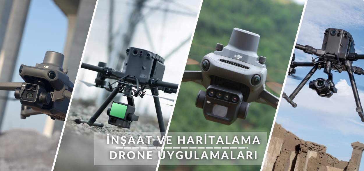
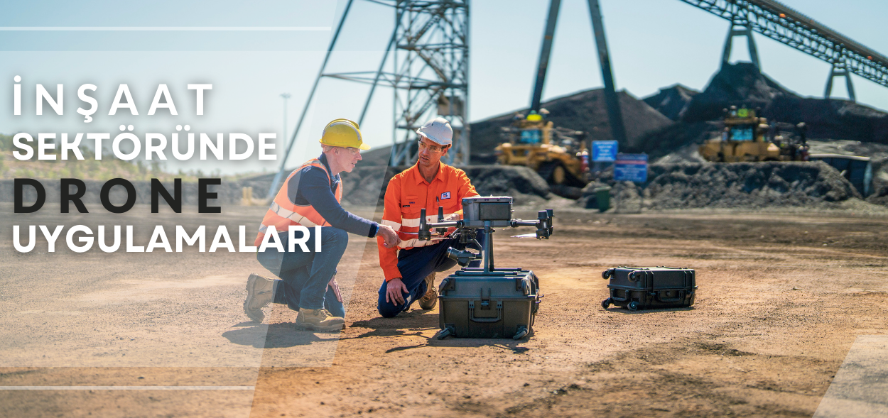
İnşaat Sektöründe Haritalama Drone Uygulamaları
Teknolojik Arka Plan
İnşaat sektöründe, dronelar; projelerin planlanması, izlenmesi ve denetiminde etkin bir araç haline gelmiştir. Haritalama amaçlı kullanılan dronelar, yüksek çözünürlüklü görüntülerin yanı sıra gelişmiş 3D modelleme ve topografya analizleri sağlar. Bu özellikler, özellikle büyük ölçekli projelerde ve karmaşık arazi yapılarında projelerin doğru ve hızlı bir şekilde yönetilmesine olanak tanır.
Uygulama Alanları
Haritalama dronelarının inşaat sektöründeki başlıca uygulama alanları:
Arazi Keşfi ve Değerlendirme: Proje başlangıcında arazinin detaylı bir şekilde haritalanması, zeminin durumunu belirlemeyi ve daha uygun bir altyapı planlaması yapmayı sağlar. Bu analizler, tasarım kararlarını iyileştirir.
Topografya ve Hacim Ölçümleri: Özellikle hafriyat çalışmalarında, droneların sağladığı hacim ölçüm araçları sayesinde kazı alanları ve dolgu malzemelerinin miktarı daha doğru şekilde hesaplanır. Bu da malzeme yönetimini kolaylaştırır ve israfı önler.
Gelişmiş Şantiye Takibi: Dronelar, şantiyenin güncel durumunu belirlemek için periyodik olarak veri toplayabilir. Bu sayede projenin ilerleme durumu uzaktan izlenebilir ve raporlanabilir. Projeye katılan tüm paydaşlar, güncel veriler üzerinden anlık bilgilere erişebilir.
Altyapı ve Güvenlik Denetimleri: Elektrik hatları, su boruları, kanalizasyon sistemleri gibi altyapı unsurlarının yerleşimi ve güvenlik durumu, droneların çektiği yüksek çözünürlüklü görüntülerle analiz edilebilir. Bu analizler, riskli alanların belirlenmesini sağlar ve güvenliği artırır.
As-Built Haritalama ve 3D Modelleme: Proje tamamlandıktan sonra, droneların sağladığı görüntülerden faydalanarak nihai yapının as-built (yapım sonrası) haritaları ve 3D modelleri oluşturulabilir. Bu sayede bina ya da yapı komplekslerinin dijital kopyaları çıkarılır, mimari ve mühendislik süreçlerinde bu modellerden faydalanılır.
Yol ve Köprü İnşaatları: Yol ve köprü gibi geniş alanları kapsayan projelerde, dronelar yol hattı boyunca toplanan verilerle yükseklik profilleri, eğim analizleri ve malzeme tahminleri yapabilir. Ayrıca bu tür projelerde inşaat sonrası bakım çalışmalarında da dronelar ile düzenli kontroller yapılabilir.
Uygulanabilirlik ve Avantajlar
Drone uygulamaları, inşaat sektöründe manuel işlemleri azaltarak maliyet ve zaman tasarrufu sağlar. Özellikle geniş ve ulaşılması zor arazilerde daha güvenli bir veri toplama süreci sunar. İleri düzey yazılımlar ile entegre edildiğinde dronelar, mühendislik süreçlerinde verimliliği artırır ve inşaat sürecinin her aşamasında değerli bilgiler sağlar.
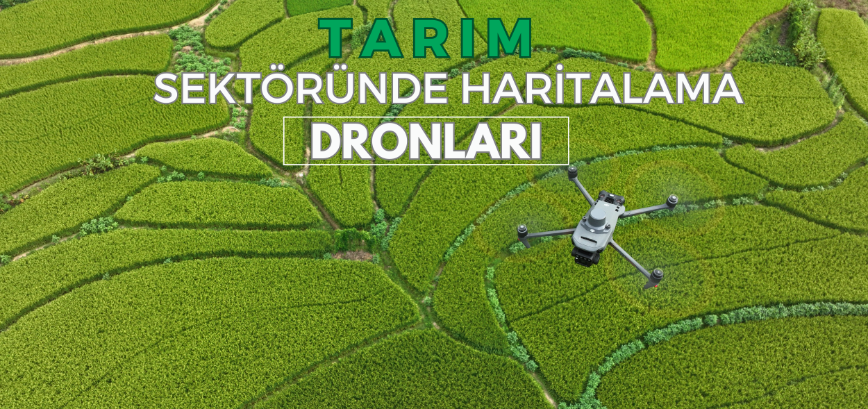
Tarım Sektöründe Haritalama Dronu Kullanımı
Teknolojik Gelişmeler
Tarım sektörü, verimliliği artırmak için son yıllarda teknolojik yenilikleri hızla benimsemiştir. Bu yeniliklerin başında gelen dronelar, özellikle haritalama ve analiz işlevleriyle çiftçilerin arazilerini daha verimli yönetmelerine olanak tanır. Haritalama dronları, çiftçilere arazi ve toprak analizi, bitki sağlığı izleme ve kaynak yönetimi gibi konularda kapsamlı veri sağlayarak hassas tarım uygulamalarını destekler.
Tarım Sektöründe Haritalama Dronlarının Uygulama Alanları
Arazi ve Toprak Haritalama
Haritalama dronları, tarım arazilerinin topografyasını ve toprak yapısını analiz ederek daha verimli ekim alanlarını belirler. Bu analizler, su drenaj kanallarının belirlenmesine ve erozyona eğilimli bölgelerin tespitine olanak tanır.
Bitki Sağlığı ve Stres Analizi
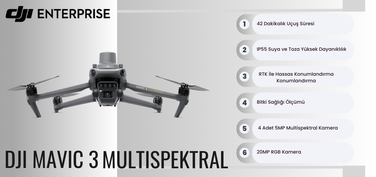
Dronlar, multispektral kameralar ile bitkilerin sağlığını ve stres durumlarını analiz eder. Hastalık veya zararlı istilaları erken dönemde fark edilerek hızlı müdahale sağlanır, böylece verim kayıpları azaltılır.
Su Yönetimi ve Sulama Optimizasyonu
Dronlar, arazide su dağılımını ölçerek kuru veya aşırı sulanmış bölgeleri tespit eder. Böylece, su israfını önleyen ve çevre dostu bir sulama yapılır. Özellikle geniş arazilerde su kaynaklarının doğru yönetimi, hem maliyet hem de çevresel sürdürülebilirlik açısından önemlidir.
Haritalama ve Verim Tahmini
Hasat döneminde dronlar, ürün yoğunluğunu ve bitki gelişimini analiz ederek hasat edilecek miktarı tahmin edebilir. Bu veriler, geçmiş yıllarla karşılaştırılarak verimliliği artırmaya yönelik stratejiler geliştirilmesine yardımcı olur.
Haşere ve Yabancı Ot Kontrolü
Dronlar, tarladaki haşere ve yabancı ot yoğunluğunu belirler. Bu sayede, yalnızca ihtiyaç duyulan alanlarda kimyasal müdahale yapılarak maliyetler azaltılır ve çevreye verilen zarar en aza indirilir.
Ekim Planlaması ve Bitki Çeşitleri Arasında Karar Verme
Dronlarla yapılan toprak ve arazi analizleri, hangi bitkilerin hangi alanlarda daha iyi yetişeceğini belirlemeyi sağlar. Bu bilgi, çiftçilerin ekim stratejilerini optimize etmelerine ve sürdürülebilir tarım uygulamalarını desteklemelerine yardımcı olur.
Haritalama dronları, tarım süreçlerini hızlandırarak çiftçilerin maliyetlerini düşürür. Arazinin hızlıca analiz edilmesi ve sorunların erken tespiti, insan gücüne olan ihtiyacı azaltır.
Hassas Tarım ve Kaynak Yönetimi
Haritalama dronları, gübre, su ve ilaç gibi kaynakların en verimli şekilde kullanılmasını sağlar. Örneğin, sadece ihtiyaç duyulan alanlara gübre veya ilaç uygulamak, maliyetleri azaltır ve çevreye zarar vermemek adına önemli bir adım olur.
Risk Yönetimi ve Sorun Tespiti
Dronlar, bitki sağlığındaki değişiklikleri veya haşere oluşumlarını erkenden tespit ederek risk yönetiminde çiftçilere yardımcı olur. Özellikle iklim değişikliğine duyarlı bitki türlerinde, erken uyarı sistemleri önemli avantajlar sunar.
Çevresel Sürdürülebilirlik
Dronlar sayesinde kaynaklar daha verimli kullanılarak kimyasal kullanım miktarı azalır ve su israfı önlenir. Bu faktörler, sürdürülebilir tarım uygulamalarını destekleyerek ekosistem üzerindeki olumsuz etkileri azaltır.
Tarımda Haritalama Dronu Kullanımının Zorlukları ve Çözümleri
Teknoloji ve Eğitim
Dronların etkili bir şekilde kullanılabilmesi için teknik bilgi gerekmektedir. Çiftçilere yönelik eğitim programları ve devlet destekli projeler, bu teknolojinin yaygınlaşmasını kolaylaştırır.
Yasal Düzenlemeler
Dronların kullanımı, uçuş izinleri ve veri gizliliği gibi yasal düzenlemelere tabidir. Çiftçiler, yerel yönetimlerin belirlediği kurallara uyarak dronları yasal çerçevede kullanabilirler.
Veri İşleme ve Analiz
Dronlar aracılığıyla elde edilen verilerin doğru analiz edilmesi önemlidir. Veri analizini kolaylaştırmak için bulut tabanlı çözümler ve tarım danışmanlık hizmetleri, çiftçilere destek olabilir.
Gelecekte Tarımda Haritalama Dronu Kullanımı ve Yeni Teknolojiler
Yapay Zeka ve Makine Öğrenimi ile İleri Düzey Analizler
Dronların topladığı veriler, yapay zeka ile analiz edilerek zararlıların ve hastalıkların otomatik olarak tanımlanması gibi daha gelişmiş uygulamaları mümkün kılacaktır.
Otonom Drone Sistemleri
Otonom dronlar, belirli programlara göre otomatik uçuş yaparak sürekli veri toplama ve analiz sağlama imkanı sunar. Böylece tarımsal süreçlerde otomasyon seviyesi artar.
Sürdürülebilir Tarım Uygulamaları ile Entegrasyon
Sürdürülebilir tarımı destekleyen dron çözümleri, çevre dostu tarım uygulamalarının yaygınlaşmasını teşvik eder. Gelişmiş analiz araçları sayesinde, çevresel etkiler en aza indirilerek doğayla uyumlu tarım yapılabilir.
Tarım sektöründe haritalama dronlarının kullanımı, çiftçilere verimlilik artışı, maliyet tasarrufu, çevresel sürdürülebilirlik ve risk yönetimi gibi birçok avantaj sağlar. Teknolojik gelişmelerle birlikte, dronların tarım uygulamalarındaki rolü giderek daha kapsamlı hale gelecektir. Eğitim programları ve teknolojik desteklerle çiftçilerin bu yenilikleri benimsemeleri, sektörde daha verimli ve sürdürülebilir bir tarımsal üretimi mümkün kılacaktır.
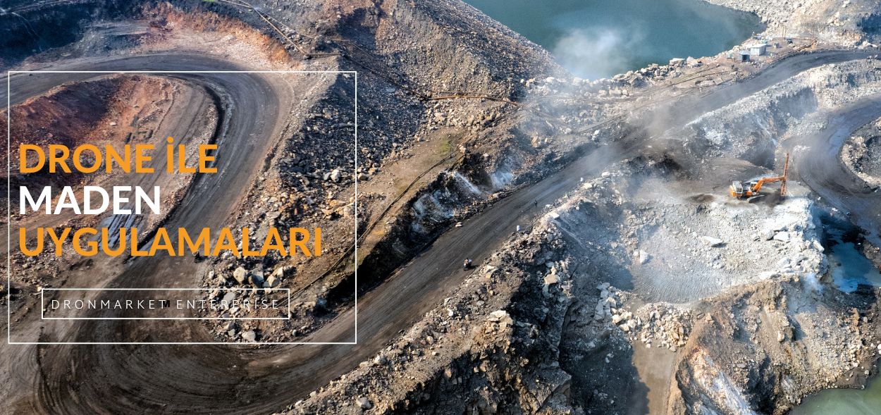
Madencilik Sektöründe Drone Kullanımı
Haritalama ve Arazi Modelleme: Droneları kullanarak maden sahalarını haritalamak ve arazi modellemesi yapmak için sıkça başvururlar. Dronelar, yüksek çözünürlüklü kameralar ve lazer tarayıcılar gibi sensörlerle donatılarak, sahanın topografyasını ve jeolojik yapısını inceleme imkanı sağlar. Üretim ve Stok Takibi: Dronelar, maden sahasındaki üretim faaliyetlerini izlemek ve stok miktarlarını belirlemek için kullanılabilir. Dronelar, sahadaki ekipmanın ve araçların hareketlerini izleyerek üretim verimliliğini artırabilir ve stok yönetimini optimize edebilir. Güvenlik ve Denetim: Maden sahalarının geniş ve zorlu doğal koşulları nedeniyle, güvenlik ve denetim önemli bir konudur. Dronelar, sahanın belirli bölgelerini düzenli aralıklarla izleyerek güvenlik önlemlerinin uygulanmasını sağlayabilir ve olası riskleri tespit edebilir. Çevresel İzleme ve Analiz: Madencilik faaliyetleri genellikle çevresel etkilere neden olabilir. Dronelar, çevresel değişiklikleri izlemek ve analiz etmek için kullanılabilir. Örneğin, su kalitesi, toprak erozyonu ve ormansızlaşma gibi çevresel faktörlerin izlenmesi için droneların kullanımı yaygındır. Yol ve Altyapı İnşaatı: Maden sahalarında altyapı inşaatı ve yol yapımı gibi projelerde droneların kullanımı giderek artmaktadır. Dronelar, sahanın genel durumunu değerlendirmek ve inşaat sürecini izlemek için kullanılabilir.
Maden Sahasını Drone ile Haritalama Çözümü ve Avantajları
Drone, madencilik sitesi fotoğraflarının otomatik olarak toplanmasını sağlayan profesyonel hava araştırması ve planlama işlevini destekler. Yazılım aracılığıyla, sadece onlarca dakika içinde yüksek çözünürlüklü bir temel harita oluşturulabilir.
Otomatik Uçuş: Dronun otomatik olarak gerekli resimleri toplamak için görev planlama işlevi. Santimetre Düzeyinde Doğruluk: Santimetre düzeyinde doğruluk haritası veri sonucu sağlamak için RTK özelliğini destekleyin. Yüksek Verimlilik, Yüksek Kalite: 0.8km2 / Uçuş, 20MP yüksek çözünürlüklü harita mevcuttur.
Sondaj ve Patlama Planlanması ile Topografi Mühendisliği Drone Çözümü ve Avantajları
DJI Solution, patlatma sonrası çıkarılacak hacmi hesaplamak için doğru bir model sağlayabilir. Dronlar ayrıca patlatma sahasının güvenliğini sağlamak için sürekli izleme sağlayabilir.
Uygun Maliyet: Helikopter ve çalışma ekibiyle karşılaştırın; drone daha uygun maliyetli bir çözüm sağlayabilir. Emniyet İyileştirilmesi: Drone, görüş sınırlaması olmadan yerinde izleyebilir ve bu da bir kayma veya başka bir olayın etkileme riskini azaltabilir. Zaman Kazanımı: Gelecekteki patlamalar için planlamayı iyileştirmek ve sahadaki zamanı azaltmak için doğru hacim hesaplaması.
Afet Yönetimi ve Acil Durum Müdahalesinde Haritalama Dronları
Afet Yönetiminde Haritalama Dronlarının Rolü
Afet yönetimi, doğal veya insan kaynaklı afetlerin meydana geldiği durumlarda toplumun güvenliğini sağlamak ve can kayıplarını en aza indirmek için hayati önem taşıyan bir alandır. Geleneksel afet yönetimi yöntemleri, sahadan bilgi toplama, hızlı değerlendirme ve karar alma süreçlerinde çeşitli zorluklarla karşılaşır. Ancak haritalama dronları (İHA - İnsansız Hava Araçları), özellikle afet öncesi, sırası ve sonrasında sağladığı hızlı ve kapsamlı veri toplama yetenekleriyle bu zorlukları aşmada önemli bir çözüm olarak öne çıkmaktadır. Bu yazıda, haritalama dronlarının afet yönetimindeki işlevlerini, sağladığı avantajları ve kullanım alanlarını ele alacağız.
Afet Öncesinde Haritalama Dronları: Risk Analizi ve Hazırlık Çalışmaları
Afet yönetiminde en önemli aşamalardan biri, afet öncesi risk değerlendirme ve hazırlık sürecidir. Dronlar, afet bölgelerinde toplanan verilerle risk analizini ve hazırlık çalışmalarını daha güvenilir hale getirir.
Riskli Bölgelerin Haritalanması: Dronlar, olası afet bölgelerinin yüksek çözünürlüklü görüntülerini sağlayarak ayrıntılı haritalar oluşturur. Fay hatları, sel yatakları, erozyon riski taşıyan alanlar gibi potansiyel riskli bölgeler dronlarla haritalanarak analiz edilir.
Altyapı ve Yapı Güçlendirme Çalışmaları: Toplanan görüntü ve veri analizleri, bölgelerdeki altyapı ve yapıların afet durumunda ne kadar güvenli olduğunu değerlendirmede kullanılabilir. Bu analizler, binaların ve köprü gibi kritik yapıların güçlendirilmesi gerektiğinde yol gösterici olur.
Tatbikat ve Eğitim Senaryoları: Afet öncesinde elde edilen detaylı veriler, afet yönetim ekiplerinin tatbikatları için gerçekçi senaryolar oluşturmada yardımcı olur. Bu durum, ekiplerin afet esnasında daha hızlı hareket etmesini sağlar ve afet anındaki müdahale kalitesini artırır.
Afet Anında Haritalama Dronları: Durum Tespiti ve Müdahale Planlaması
Afet anında, hızlı ve doğru bilgi toplama afet yönetiminde başarıyı artırır. Haritalama dronları, afet bölgesine ulaşıp durumu hızlı bir şekilde analiz ederek, kurtarma ekiplerine önemli bilgiler sunar.
Hızlı Durum Tespiti ve Hasar Değerlendirmesi: Dronlar, afet bölgesinde hızlı bir uçuş yaparak durumu değerlendirebilir. Örneğin, deprem sonrası binaların hasar durumu veya sel sonrası suyun kapladığı alanlar dronlar aracılığıyla kısa sürede haritalanabilir.
Yaralıların ve Mahsur Kalanların Tespiti: Dronlara eklenen termal kameralar, özellikle enkaz altında veya karanlıkta kalan insanların yerini tespit etmekte etkili bir araçtır. Mahsur kalanların hızlıca tespit edilmesi, arama kurtarma ekiplerinin zaman kaybetmeden müdahale etmesine olanak tanır.
Yardım Götürme Planlaması: Afet sırasında yollar ve köprüler gibi altyapı unsurları hasar görebilir. Dronlarla toplanan veriler sayesinde yolların durumu hızlı bir şekilde analiz edilerek ulaşıma açık olan yollar belirlenebilir. Bu bilgi, yardım ekiplerinin rotalarını belirlemesine yardımcı olur.
Afet bölgelerinde arama kurtarma operasyonları genellikle geniş alanlarda yapılır ve bu durum hem zaman hem de kaynak israfına yol açabilir. Haritalama dronları, geniş alanları kısa sürede tarayarak kayıp kişilerin yerini belirlemede büyük avantaj sağlar.
Zor Ulaşılan Bölgelerde Veri Toplama: Bazı afetlerde, örneğin büyük yangınlar veya heyelanlar sonrası, bölgenin tamamına ulaşmak zor olabilir. Dronlar, bu tür zorlu bölgelere güvenli bir şekilde ulaşarak görsel veri toplar ve ekiplerin zorlu koşullarda çalışmasını kolaylaştırır.
Kapsamlı Görüntüleme ve Yönlendirme: GPS özellikli dronlar, kayıp kişilerin koordinatlarını belirleyerek kurtarma ekiplerine hızlı bilgi aktarır. Özellikle yüksek çözünürlüklü kameralar, dar geçitler veya yoğun ormanlık alanlarda dahi etkili bir görüş sağlar.
Zaman ve Kaynak Tasarrufu: Dronların geniş alanları kısa sürede tarayabilmesi, arama kurtarma operasyonlarında büyük zaman kazancı sağlar. Bu da kaynakların en çok ihtiyaç duyulan bölgelere yönlendirilmesine ve verimli bir operasyon süreci yürütülmesine imkan tanır.
Afet Sonrası Dönemde Haritalama Dronları: Hasar Analizi ve Yeniden İnşa
Afet sonrasında, etkilenmiş bölgelerde hasar analizi yapmak, toparlanma sürecinin hızlı ve planlı bir şekilde yürütülmesi için önemlidir. Dronlar, afet sonrası toparlanma sürecinde de önemli bir rol oynar.
Hasar Tespiti ve Yeniden Yapılandırma Planlaması: Dronlarla çekilen görüntüler, afet sonrası binaların, yolların ve altyapının hasar durumunu değerlendirerek onarım önceliklerini belirlemeye yardımcı olur. Bu veriler, altyapının yeniden inşası sürecinde yol gösterici olur.
Sigorta ve Tazminat Süreçleri: Dronların sağladığı detaylı görseller ve veriler, sigorta şirketlerinin hasar tespiti yapmasını kolaylaştırır. Bu da tazminat süreçlerinin hızlandırılmasına ve afet mağdurlarına hızlı destek sağlanmasına yardımcı olur.
İleriye Dönük Altyapı Geliştirmeleri: Dronlarla toplanan afet sonrası veriler, gelecekte benzer durumlara karşı daha dayanıklı altyapıların inşa edilmesinde kullanılır. Örneğin, hasar alan yollar ve köprüler, afet sonrası toplanan verilere dayanarak daha dayanıklı malzemelerle güçlendirilebilir.
Haritalama dronlarının afet yönetiminde sağladığı avantajlar oldukça fazladır. Bu avantajlar, afet yönetiminde süreci hızlandıran ve daha etkili kararlar almayı sağlayan önemli faktörlerdir.
Hız ve Verimlilik: Dronlar, afet anında bilgi toplama sürecini hızlandırır ve geniş alanları kısa sürede tarayabilme özelliğine sahiptir. Bu hız, acil durumlarda hayat kurtarıcı müdahalelerin daha hızlı yapılmasını sağlar.
Ulaşılamayan Alanlara Kolay Erişim: Afet bölgelerindeki erişimi zor veya tehlikeli alanlarda dronlar güvenli bir şekilde uçuş yaparak veri toplar. Bu durum, insan hayatını riske atmadan bilgi toplanmasını sağlar.
Düşük Maliyet ve Etkinlik: Dronlar, helikopter veya insan gücüne göre daha düşük maliyetlidir. Bu da afet bölgelerinde kaynakların verimli bir şekilde kullanılmasına olanak tanır.
Güncel ve Detaylı Veri Sağlama: Dronlar, afet yönetiminde karar alma sürecini hızlandırmak için güncel veri sağlar. Anlık görüntüler, afet bölgesinin detaylı bir analizini sunarak afet yönetim ekiplerine yol gösterir.
Afet Yönetiminde Haritalama Dronlarının Zorlukları
Her teknolojide olduğu gibi, haritalama dronlarının da afet yönetiminde bazı zorlukları bulunmaktadır. Ancak bu zorluklar, yeni teknolojik gelişmelerle aşılabilir.
Yasal Düzenlemeler ve İzinler: Afet bölgelerinde dron kullanımı, yasal düzenlemelere tabidir. Bu düzenlemeler bazen hızlı müdahale gerektiren durumlarda gecikmelere yol açabilir. Bu nedenle, afet bölgeleri için özel yasal düzenlemelere ihtiyaç vardır.
Teknik Yeterlilik ve Eğitim: Haritalama dronlarını etkili bir şekilde kullanmak için eğitim gereklidir. Afet anında profesyonel operatörler olmadan dronları etkin bir şekilde kullanmak zor olabilir.
Veri Analizi ve Yönetim Zorlukları: Dronlardan elde edilen büyük miktardaki verinin işlenmesi, hızlı karar almayı zorlaştırabilir. Bu durum, yapay zeka ve büyük veri teknolojileriyle veri analiz süreçlerinin hızlandırılmasıyla aşılabilir.
Sonuç: Afet Yönetiminde Dronların Gelecekteki Rolü
Haritalama dronları, afet yönetiminde hem hızlı veri sağlama hem de erişilemeyen alanlara ulaşım konularında devrim niteliğinde bir çözüm sunmaktadır. Bu dronlar, afet öncesi hazırlık çalışmalarından afet sonrası toparlanmaya kadar sürecin her aşamasında etkili bir şekilde kullanılabilir. İlerleyen yıllarda, dronların yapay zeka ile entegre edilmesi, afet yönetiminde daha hızlı ve güvenilir çözümler sunacaktır. Afet yönetiminde haritalama dronlarının kullanımı, hem hızlı hem de etkin müdahalelerin yapılmasını sağlamak için gelecekte daha yaygın hale gelecektir.
Drone İle Orman Yönetimi ve Çevre İzleme
Orman Yönetiminde Teknoloji Kullanımının Önemi
Ormanlar, küresel ekosistem üzerinde hayati bir etkiye sahip ve dünya genelinde biyolojik çeşitliliğin korunmasında kilit rol oynuyor. Ancak iklim değişikliği, ormansızlaşma, kaçak kesimler ve doğal afetler gibi tehditler, ormanların sağlığını ve devamlılığını giderek zorlaştırıyor. Bu noktada, drone teknolojisi orman yönetiminde ve çevre izleme süreçlerinde önemli bir yenilik olarak karşımıza çıkıyor. Dronlar, geniş ormanlık alanların hızlı ve güvenilir bir şekilde haritalanması, ekosistemin izlenmesi, kaçak kesimlerin önlenmesi ve yangın takibi gibi birçok alanda etkin çözümler sunuyor.
Orman Yönetiminde Drone Kullanım Alanları
Dronelar, orman yönetimi alanında farklı görevlerde kullanılarak hızlı veri sağlama, geniş alanları kolayca tarama ve tehlikeli durumlara karşı önlem alma konularında büyük faydalar sağlıyor. İşte orman yönetiminde drone kullanımının başlıca alanları:
Orman Envanteri Oluşturma ve Haritalama: Ormanlık alanların düzenli haritalanması, orman envanterinin doğru bir şekilde oluşturulmasını sağlar. Dronlar, ormandaki ağaç türlerini, ağaç yaşlarını ve yoğunluğunu analiz ederek, orman envanterlerinin düzenli olarak güncellenmesine yardımcı olur. Yüksek çözünürlüklü görüntüler ve LIDAR gibi ileri seviye sensörler, bu analizin doğruluğunu artırır.
Ağaç Sağlığı ve Hastalık Tespiti: Ormanlardaki ağaçların sağlığı, drone aracılığıyla düzenli olarak izlenebilir. Dronlara entegre edilen multispektral kameralar sayesinde, bitkilerin sağlık durumu hızlıca analiz edilebilir. Bu sayede orman yöneticileri, hastalık belirtilerini erken dönemde fark ederek hızla önlem alabilir. Özellikle çam kese böceği, kabuk böceği ve mantar gibi ağaç sağlığını tehdit eden faktörler, dronlar sayesinde erkenden tespit edilebilir.
Kaçak Kesim ve Ormansızlaşma Tespiti: Dronlar, ormanlardaki kaçak kesimleri ve ormansızlaşmayı hızlıca tespit edebilir. Ormanlık alanların düzenli taranması sayesinde, izin verilmeyen alanlardaki ağaç kesimleri anında fark edilebilir. Kaçak kesimlerle mücadelede oldukça etkili olan bu teknoloji, ormanların korunmasına katkıda bulunur.
Yangın İzleme ve Yangına Müdahale: Orman yangınları, ekosistem üzerinde yıkıcı etkiler bırakır. Dronlar, yangın sezonunda ormanlık alanları sürekli izleyerek yangın riski taşıyan alanları belirleyebilir ve erken müdahale için sinyal verir. Özellikle termal kameralar, duman veya ısı dalgalarını uzaktan tespit ederek olası bir yangının erken fark edilmesini sağlar.
Çevre İzleme ve Ekosistem Koruma
Dronlar, sadece orman yönetiminde değil, aynı zamanda çevre izleme ve ekosistem koruma çalışmalarında da büyük bir etki sağlar. Dron teknolojisi, çevresel değişiklikleri izleyerek doğal yaşam alanlarının korunmasına destek verir.
Ekosistem Sağlığı İzleme: Dronlarla elde edilen yüksek çözünürlüklü görüntüler, ekosistem sağlığını analiz etmek için kullanılır. Orman tabanında yer alan bitki örtüsü, su kaynakları ve doğal yaşam alanları, drone görüntüleri sayesinde izlenebilir. Bu analiz, ekosistem dengesinin korunmasına katkı sağlar.
Su Kaynaklarının Takibi ve Analizi: Dronlar, ormanlık alanlardaki su kaynaklarının durumunu ve kalitesini izlemekte de kullanılır. Nehirler, göller ve su havzalarının düzenli olarak izlenmesi, çevre sağlığı açısından önemlidir. Su kaynaklarının durumu hakkında bilgi sağlamak, orman ekosisteminin sağlığını korumak için kritik bir adımdır.
Yaban Hayatı İzleme ve Koruma: Dronlar, yaban hayatını izlemek ve bu alanda veriler toplamak için kullanılabilir. Hayvanların yaşam alanlarını görüntülemek, popülasyonları hakkında bilgi sağlamak ve tehdit altındaki türlerin korunmasına yardımcı olmak için oldukça etkilidir. Özellikle hassas hayvan türleri üzerinde gözlem yapmak, onların doğal yaşamlarını bozmadan, uzaktan takip etmeyi sağlar.
Hava Kirliliği ve Karbon Emisyonu İzleme: Dronlara entegre edilen sensörler sayesinde, hava kalitesini izlemek ve karbon emisyonunu takip etmek mümkündür. Orman alanlarında hava kirliliği tespiti ve karbon depolama kapasitesinin ölçülmesi, çevre koruma açısından önemli bir rol oynar.
Drone Kullanımının Avantajları
Orman yönetimi ve çevre izleme çalışmalarında drone kullanmanın birçok avantajı bulunmaktadır. İşte bu teknolojinin sunduğu başlıca faydalar:
Hız ve Verimlilik: Geniş ormanlık alanları kısa sürede tarayabilen dronlar, zaman ve kaynak tasarrufu sağlar. Geleneksel yöntemlerle günlerce sürecek bir orman incelemesi, dronlar sayesinde saatler içinde tamamlanabilir.
Ulaşılamayan Alanlara Kolay Erişim: Ormanlık alanların yoğunluğu veya engebeli yapısı nedeniyle bazı bölgelere ulaşım zor olabilir. Dronlar, bu bölgelere rahatça erişim sağlayarak verilerin güvenli bir şekilde toplanmasını mümkün kılar.
Doğru ve Anlık Veri Sağlama: Dronlar, ormanlık alanların gerçek zamanlı görüntülerini sağlayarak güncel bilgi sunar. Bu da çevresel değişiklikleri yakından izleme ve gerektiğinde hızlı karar alma imkanı tanır.
Düşük Maliyetli Çözüm: Dronlar, helikopter veya insan gücüne dayalı yöntemlere göre daha düşük maliyetli bir seçenektir. Ayrıca, geniş alanları daha az insan kaynağıyla izleme imkanı sunarak bütçe tasarrufu sağlar.
Çevresel Koruma ve Sürdürülebilirlik: Ormanlık alanları ve çevreyi izlerken düşük karbon emisyonuna sahip olan dronlar, çevre dostu bir çözüm sunar. Bu da çevreye zarar vermeden ekosistemin korunmasına katkıda bulunur.
Dron Kullanımının Zorlukları ve Çözüm Yolları
Her ne kadar drone teknolojisi orman yönetiminde önemli faydalar sağlasa da bazı zorluklarla karşılaşmak mümkündür. Bu zorluklar, yeni teknolojiler ve düzenlemelerle aşılabilir.
Yasal Düzenlemeler: Ormanlık alanlarda drone uçurmak, bazı yasal düzenlemelere tabidir. Bu düzenlemeler, kaçak kullanım ve gizlilik ihlallerini önlemeyi amaçlar. Bu nedenle, orman yönetiminde drone kullanacak kişiler gerekli izinleri almalı ve yasal sınırlamalara uygun hareket etmelidir.
Eğitim ve Teknik Bilgi Gereksinimi: Orman yönetimi alanında dronların verimli bir şekilde kullanılabilmesi için teknik bilgi ve deneyim gereklidir. Özellikle sensör kullanımı ve veri analizi için özel eğitimlere ihtiyaç duyulabilir. Eğitim programları ve teknik destek sağlayıcıları, bu konuda kullanıcıları eğitebilir.
Veri İşleme ve Analiz: Drone ile toplanan verilerin analiz edilmesi, doğru sonuçlar elde etmek için önemlidir. Gelişmiş veri analiz yazılımları ve yapay zeka, çevresel analizlerde veri işleme sürecini hızlandırarak bu zorluğu azaltabilir.
Drone ile Orman Yönetimi ve Çevre İzlemenin Geleceği
Gelecekte, drone teknolojisinin gelişmesiyle birlikte orman yönetiminde daha etkili sonuçlar elde edilmesi beklenmektedir. Yapay zeka, makine öğrenimi ve sensör teknolojilerinin entegrasyonu, ormanlık alanlarda daha detaylı analizler yapılmasını sağlayacaktır. Ayrıca, otonom dronlar sayesinde çevre izleme faaliyetleri daha bağımsız hale gelecek ve dronlar kendi başlarına rutin izleme görevleri gerçekleştirebileceklerdir. Bu yenilikler, orman yangınları gibi ani olaylara karşı daha hızlı önlem almayı sağlayacak, ormansızlaşmanın önlenmesi ve doğal kaynakların korunması konusunda daha etkin çözümler sunacaktır.
Sonuç
Drone ile orman yönetimi ve çevre izleme, doğal kaynakların korunmasında ve çevre sağlığının izlenmesinde önemli bir adımdır. Drone teknolojisi, orman yönetiminde hız, doğruluk ve maliyet avantajı sunarken, ekosistemin korunmasını sağlayacak çok yönlü bir araç haline gelmiştir. Dronların sunduğu olanaklarla ormanların sürdürülebilir yönetimi sağlanırken, doğaya duyarlı çözümler geliştirilerek gelecek nesiller için daha sağlıklı bir çevre oluşturulabilir.