Detaylı incelemek için çift tıklayın


Ürün Fiyatı
31.915,04 TL
Sık Sorulan Soruları Gör
RTK FOR UAV MAPPING GNSS MODULE Centimeters in RTK and PPK Positioning with Precision. Precise with Less GCP For Mapping Emlid Reach M2 Multi-band baseline up to 100 Km in PPK | 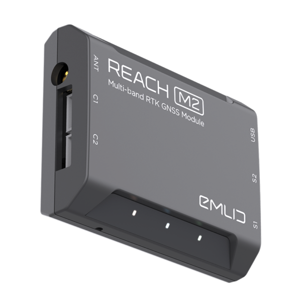 |
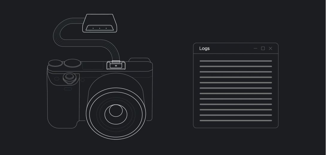
Centimeter Precision Using Less GCP PPK Mapping. | Why Is Camera Sync So Important? Usually autopilot triggers the camera and currently has saves the coordinate. If the drone is flying at 20 m/s and the GPS is working at 5 Hz, this is your autopilot only every 4 meters means it will have location reading; which is not suitable for precise georeferencing. Also, the photo with the trigger There is always a delay between the actual moment it was taken. Reach Eliminates Latency. Reach to camera hot shoe port synced with shutter It solves the positioning problem by connecting directly. The duration and coordinates of each photo, in less than a microsecond recorded at a lower resolution. This method only Allows the use of GCPs to control |
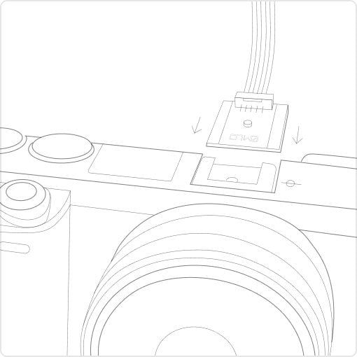 1.Reach on camera To the Hot Shoe port connect it. Every time a photo is taken, camera a shutter synchronized to the opening on the flash shoe connector produces a pulse. | 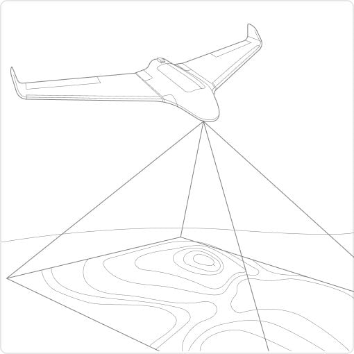 2. Take your flight, Reach photo events will save. Reach, sub microsecond flash sync with resolution catches your blows and them in internal memory. stores the raw data in a RINEX log. | 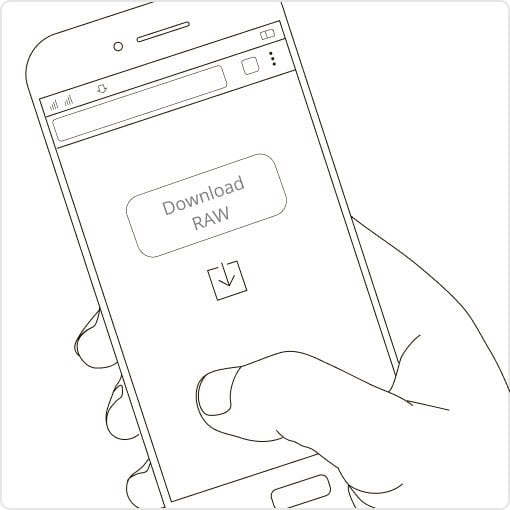 3.Reach Logs and Download from Base Station. RINEX airborne after flight from your Reach module and a logs in from the base station (Reach RS, CORS or other receivers). | 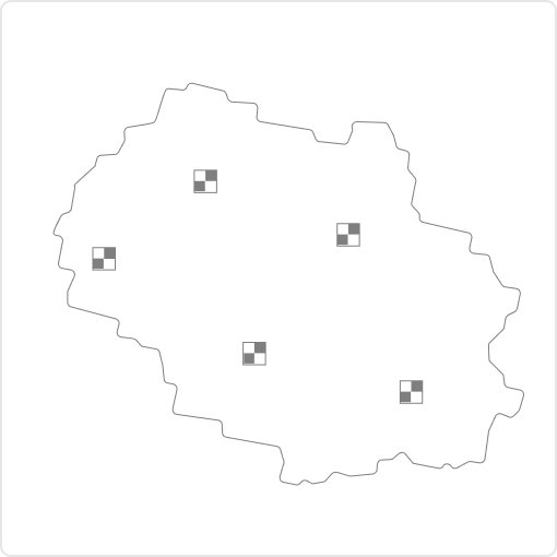 4. Process logs and geolocation of photos Get the file containing it. Free RTKLIB software Process RINEX files using Your photos for georeferencing file produced with exact coordinates available. |
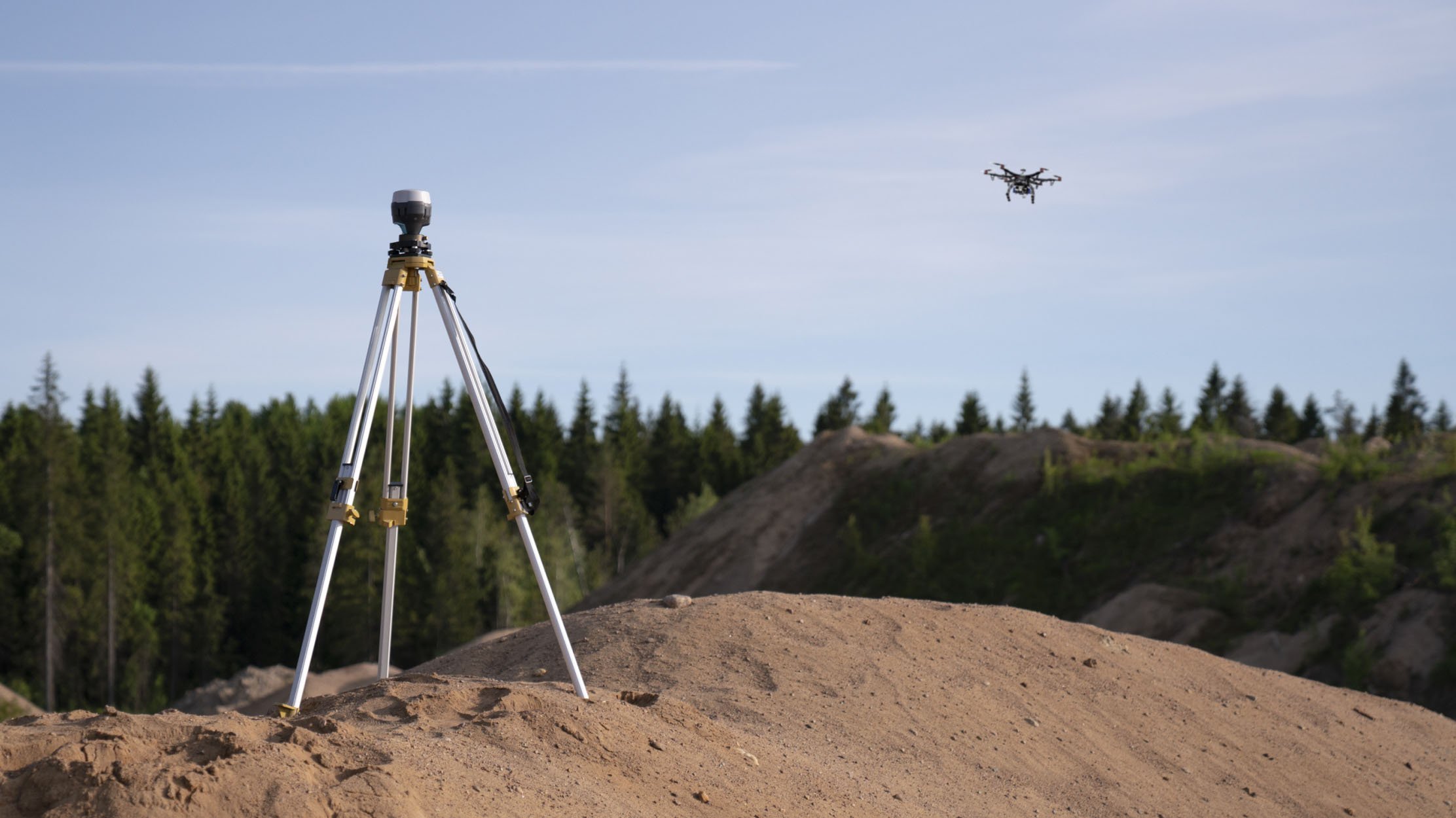
NTRIP or another Base station access as Centimeter exact coordinates in PPK and RTK from a base station of Reach to calculate they need to fix. Another Reach receiver or the NTRIP service. VRS is also supported. Compatibility Reach M2 and M+ via any link works seamlessly with other Reach receivers. Compatible with other receivers that support RTCM3 and NTRIP. | Reach M+ and Reach M2 Choose Between
|
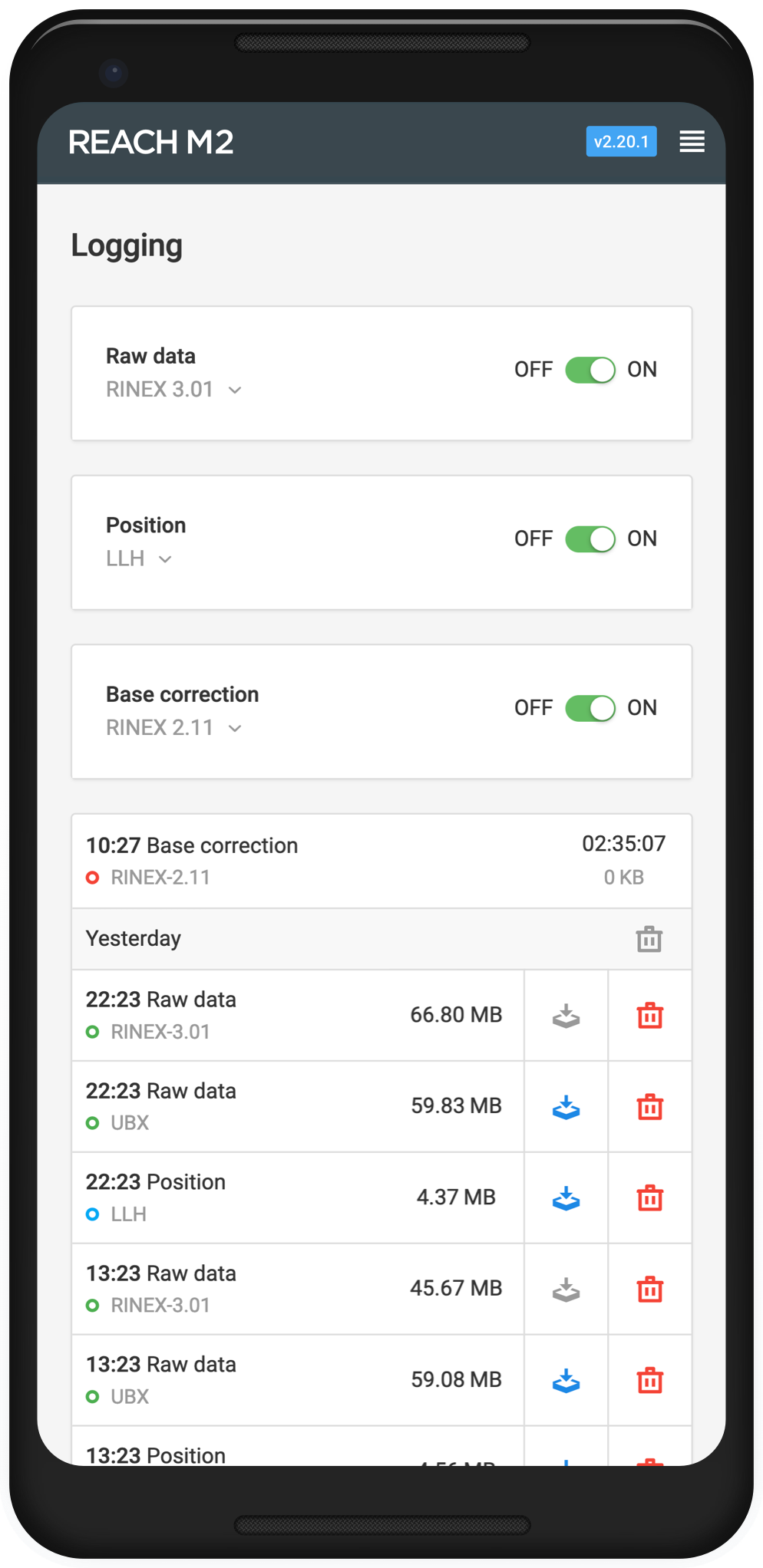 | Applications run with a Geliyo ReachView software for data collection available for both Android and iOS It is the easiest to use. With ReachView, setting up a base station, RINEX such as saving data, configuring NMEA output, and monitoring data. You can check all the features of the receivers.
|
3DroneMapping, all mean zero in axes PPK with mean error completed his trials. Luke Wijnberg, 3DroneMapping As a brief summary of the results, the maximum deviation of the points was not more than 0.09m in all axes. This is obtained the fact that the average pixel size of the image is 0.045m It is an incredible result. in all axes the mean mean error is only a few mm. | 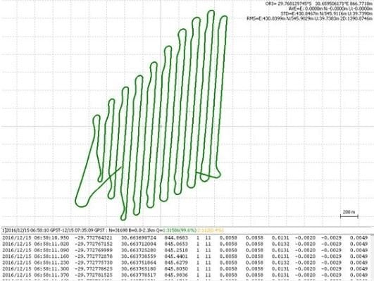 |
Blown, with Emlid Reach RTK 4cm without GSOs takes sensitivity. Brian Christal, Blown Tuffwing recently released precision maps without using GCP performed the Emlid Reach RTK integration to create System directly georeferenced model, only error detection Compared with a set of GCPs used for in hand The lateral RMS error reported is only 4 cm according to the Pix4D quality report. | 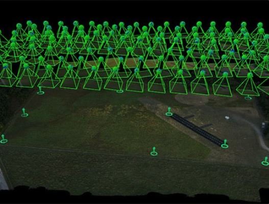 |
Event38 integrate Emlid Reach and ready-to-use PPK to provide mapping solution starts. Jeff Taylor, Event38 In this case study, Drone Data Management System ™ A survey with a 2.45 cm horizontal and 5.08 cm vertical RMSE was carried out with GPS. We produced an orthomosaic when we compared it. | 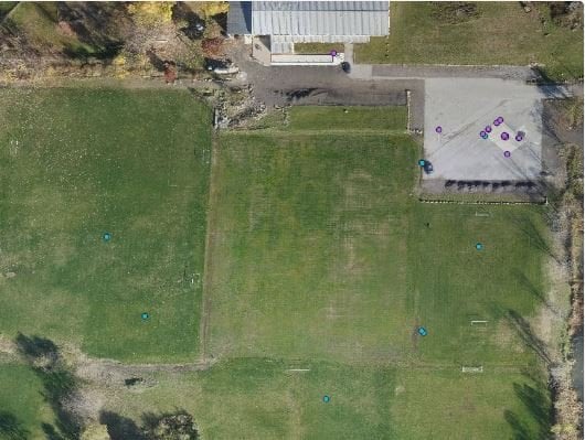 |
M2
Mechanical
Electricity
Positioning
Connection
Data
GNSS
Be the first to review this product!