Mapping Solutions
Mapping with Drone
There are many ways to map with drones. First of all, of course, your drone must have the necessary features for mapping.
ALTAR X4 and ALTAR X6M Surveyor Drone and Alaras UAV, produced by Dronmarket, embody these features.
For more detailed information about our drones, we are just a phone call away.
The drone goes to the coordinates we enter from our flight computer with 0 deviation and takes pictures from the air at those points. After taking pictures at each point
Visuals are analyzed with a special program and the map of the land is taken in the resolution you want.
As the Dronmarket team, we continue to be your solution partner in mapping.

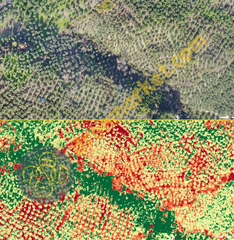
Mapping Example
At the request of our customer, a current 2D map and 3D map of the land you see below have been produced.
If you wish, you can find the coordinates and locations of any tree from these photos.
With special mapping drones that receive precise location information, produced by our R&D team.
It is possible to make an error-free measurement and mapping.
All of the high resolution and precision images we receive from our drones, which are specially made for Drone Mapping,
It is combined with our high-performance computers and the current map of your land is presented to you.
Thanks to RGB Cameras, soil analysis of the land, analysis of plants, spraying
It is also possible to find areas that need care or maintenance.
3D Mapping with Drone
In our previous three-dimensional mapping work, we scanned the ancient Midas Monument in Yazılıkaya, Eskişehir and its surroundings. Now, we tried to model the "Fairy Tale Castle" located in Eskişehir Sazova Science Culture and Art Park, which is a more complex structure. What makes Masal Castle special is that it houses minarets and towers similar to many parts of Turkey, the biggest tower is 50 meters long and is a copy of the Galata Tower in Istanbul, and its other towers are the Yivli Minaret in Antalya, Diyarbakır. The Bell Tower consists of the Justice Tower in Topkapi Palace, the Maiden's Tower in Istanbul, the Ulucami minaret in Mardin and the Burgulu Minaret in Amasya.
Again , we took photos with Phantom drones, thanks to the 12 MP camera, we can get sharp photos, it is possible to adjust many camera settings such as ISO value and White Balance, thanks to the DJI Go smartphone application. Phantom series drones allow us to take images in the air for up to 20 minutes, 10 minutes is enough to take approximately 150 photos. All photos are saved on the SD card on the drone.
For more detailed information, you can reach us from our contact information.
If we wish, we can print the model we created on a 3D printer.